


Wrong Number of Dimensions
Some stats are more limited than their users realize.
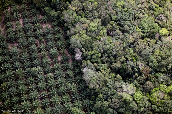
Satellite photos are often used to evidence deforestation and reforestation. They are two-dimensional images, but biomass in a forest correlates with volume, which means the height of the trees must be considered — the third dimension. Another problem is that reforestation typically converts public land to private ownership.
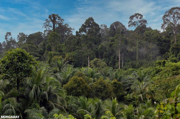
The following photos were taken by Rhett Butler of Mongabay in 2012. They contrast the height of a palm oil (sawit) plantation with the trees in an adjacent forest in Sabah, a state of Malaysia on the island of Borneo. A satellite view would show very thorough coverage of “greenery” in this area.
The first photo shows the boundary at ground level with sawit in the foreground:
The second photo is an overhead view, showing sawit at the left:
Selective felling of commercially usable trees keeps other trees intact, with less damage to the forest than clear cutting. However, the cut species often cannot be successfully reforested afterward. This is because their seedlings will be shaded by the other trees who have been spared harvesting.
National development often measures the transportation sector by miles/kilometers of paved roads. But that is only one dimension. Widening a road does nothing to increase the stat, but it is a boon to drivers who want to overtake slower vehicles. I wonder when the World Bank et al will add the second dimension to this stat?